Orography
Orography is the branch of physical geography that studies the formation and characteristics of mountains. The word comes from the Greek ὄρος, which means mountain, and -graphy, whose translation is description. It is also known in the branch of geography with names of orology. It is responsible for researching and studying the formation and development of mountains, hills and ridges, for example, the formation of a mountain range or a group of ridges is known as an orogeny. The orography fits more broadly into the study of Geomorphology, which is not necessarily limited to the characteristics of the surface, as in the case of topography.
What is orography?
The orography is a physical geography branch that is in charge of discovering and classifying the different types of reliefs or elevations of the terrestrial crust, that is to say, the forms of the surface, taking into account their external features.
What does orography study?
Orography is the part of geography that is in charge of carrying out studies and descriptions about the different types of mountains that we can observe in the terrestrial relief. These studies and descriptions are carried out through different cartographic representations, better known as maps, where it will be possible, thanks to it, to visualize and to make studies about the type of relief that presents a certain region.
Types
The orography has different forms that characterize a relief, and these are: mountains, plains, volcanoes and valleys. In addition, in the different coastal zones we can find the cliffs and the beaches.
Importance
Studies based on orography are of great importance for geographers and governments, because through them it is possible to make different plans on the different infrastructure works. It studies the different characteristics of the land in order to build buildings and roads. It also plays a fundamental role in the branch of agriculture and mining, because through it, important and fundamental analyses are carried out to get to know the soil and subsoil characteristics of a place. It is basic to make adequate use of natural resources.
The orography also plays an important role in climate and changes that occur in it in different places, this happens because due to the amount of mountains in a place, rainfall will be influenced by the upward movement of air, which generates the process of condensation, in addition, the peaks of the different mountains are responsible for accelerating the speed that wind has. In other words, orography influences the amount of precipitation, cloudiness and wind that can be recorded in a given place.
Europe orography
Europe is one of the continents with one of the largest ranges of orography. In it, we can find the following:
- The Alps: This is the most important orographic system in Western Europe.
- The Apennines: System in which the Vesuvius Volcano, Mount Corno and Mount Etna stand out on the island of Sicily.
- The Dynamic Mountains.
- The Scandinavian Mountains.
- The Ural Mountains, which serve as the border between Europe and Asia.
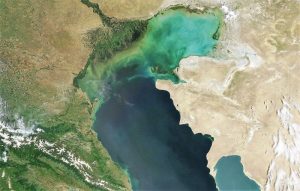
- The Caucasus Mountains, located between the Caspian Sea and the Black Sea.
- We also find in Europe great volcanoes, plains and plateaus. It is in the European plains where we find the greatest amount of human concentration and development. The main plains are: Po Plain, North European Plain, Hungary, Russian Plain.
American orography
In North America we can find the following orography:
- The Canada Shield: which is located in the northeast of the continent and is formed by a series of glaciations.
- The Appalachian Mountains: located from eastern Canada to the eastern central U.S.
- The Folded Massif of the West: which develops from Alaska to Mexico and is composed of two mountain ranges: the Rocky Mountains and the Coastal Chain.
- The Plateaus: which are high plateaus ranging from the Coastal Chain to the Rocky Mountains. The most important are Alaska, Colombia, the Great Basin and Colorado.
- The plains: the main ones are the Arctic, Central Canadian, Mississippi, Atlantic and Gulf of Mexico plains.
In Central America, countries form different mountain ranges with low elevation and are characterized by volcanic activity.
- The highest volcanoes are Tajamulco and Tacang.
- In the Caribbean islands their mountains belong to a chain that is born in Cuba.
In South America we can find the wonderful Andes Mountain Range that runs from North to South the South American West. It has a length of 8900 km and extends from Venezuela and Colombia to the eastern end of Tierra del Fuego. Its average height is very high, has high peaks and a compact formation. Some of its highest peaks are:
- Aconcagua, 6,959 m.
- Ojos del Salado, 6864 m.
- Tupungato, 6882 m.
On the east coast of South America are the Guyana and Brazil massifs that make up the main mountain systems. The plains found in this place are associated with important basins such as the Orinoco, the Amazon and the Silver.
Mexico orography
Mexico has a fairly rugged soil with a large number of hills, mountain ranges, mountains and volcanoes. Its economy and the country’s development has been greatly influenced by the type of relief. The main elevations that we can find in Mexico are the following:
- Sierra Madre Occidental
- Sierra Madre Oriental
- Neo volcanic Mountain Range
- Sierra Madre del Sur
- Sierra Madre de Chiapas
- Californian Sierra
Orography of Spain
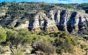
It is characterized for being very high and mountainous. Its mountainous systems are very numerous and cover almost half of the national territory. Among the most important orography that we can find in Spain are:
- The Pyrenees
- Baetic systems, which have the highest mountain ranges.
- Cantabrian Mountains
- Eastern Iberian System
- Sierra Morena
- Toledo Mountains
- Archipelagos such as the Balearic Islands and the Canary Islands.
- In addition, the coast of Spain, which is bathed by the Atlantic Ocean, the Cantabrian Sea and the Mediterranean, has an extensive variety of beaches, cliffs and rivers.
Orography of Bolivia
The Bolivian territory has two important orographic contrasts: the Mountainous Zone, part of the American Andean System, and the Eastern Zone or the Plains. The Eastern Plains occupy most of the national territory and belong to the Amazon River Basin. The Western region is made up of the backbone of the Andes, which begins in Venezuela and Colombia and ends in Argentina and Chile. In Bolivia, this mountain range is divided into two parts: the Western Mountain Range of volcanic origin, where we can find formations such as:
- Sajama
- Licancabur
- Ollagüe
The Cordillera Real or Oriental has several secondary mountain ranges such as La Paz, Tres Cruces and Los Lípez. The most important peaks of this mountain range are:
- Illimani,
- Ankohuma
- Illampu
- Mururata
- Huayna
- Potosí
How to cite this article?
Briceño V., Gabriela. (2019). Orography. Recovered on 4 January, 2025, de Euston96: https://www.euston96.com/en/orography/


